Monday, November 30, 2009

The Secret Out

The season of Larja, the season of built up for the wet, is now moving along and away from country. The winds strengthen from westerly to north – westerly during this time. Gubinge (Terminalia ferdinandiana) and the white gum gunurra (Eucalyptus) Corymbia flavescens are in flower. It was a great year for bush honey. Stingray, reef and shellfish were fat. Turtles are now mating. Country is eager and waiting for the arrival of Mankala, the wet. Strong north-westerly winds and cyclones (wirdu wangal) will blow throughout this season. Ngaliwany (Persoonia falcate), gabiny (Terminalia ferdinandiana) and magabala (Marsdenia viridiflora) are all heavy with fruit. Flying foxes are all out getting fat on the fruits of this season. Kangaroos are skinny, as are the shellfish. Bush honey will be hard to find. Turtles are now laying eggs.

And the enemies of Country, Woodside, Western Australian State Government and now the Broome Shire Council are all in cohoots, determine to destroy Country. They can try and hide behind their corrupt paperwork and their moot deceitful processes. They can imagine that they have the God given right the rip Country away from people and destroy biodiversity because of their blinding ambitions to satisfy their greed, their selfish orientated egos without any thought for future generations, our community, our Country and our planet. They are dreaming up a nightmare for their own children. It is not going to happen! Dream on!

Wednesday, November 25, 2009

Drilling Kimberley LNG Precinct James Price Point

Drilling has commenced along the Manari Road between the Quondong Point turnoff and James Price Point by Hagstrom Drilling.
During the site selection process for the Kimberley LNG Precinct there were 3 proposed locations at James Price Point with the southernmost section located near Quondong.
Given the Shire of Broome’s approval for the installation of a meteorological tower at location “Option A”, it appears that the Kimberley LNG Precinct will be located nearer to Quondong than to James Price Point this slashes through the Lurujarri Dreaming Trail, breaking the song cycle that travels along the coast line of the western side of the Dampier Peninsula.
Last week and weekend while a tower was installed significant drilling was also underway in a number of places between James Price Point and Quondong, drilling day and at night under massive floodlights. The road has been remade in places and there has been much heavy vehicle traffic, no doubt in a hurry before the ‘wet’ season starts. In fact this part of the road is like a river during the rain - see an earlier post on Hands off country “Unique, Untouched, Spectacular” – not any more. Surveys continue including the beaches at Quondong.

At the next Shire Council meeting on Thursday 26 November, Council will consider Pro oil and gas development Councillor Jenny Bloom’s Notice of Motion to ‘acknowledge’ the State’s selection of James Price Point, to ‘recognise’ Government Policy on the Kimberley LNG Precinct, to ‘resolve to co operate and participate’ with the Government and ‘reconfirm’ an earlier resolution supporting the Port of Broome. This opposes Council’s resolutions of last December and November. The Broome community would do well to ask what information has been provided to both the Shire and to the general community for the Shire to change its view?
One wonders how much Indigenous and local employment in the construction, transport, drilling, and surveys to date?
Hands off country

Thursday, November 19, 2009

Woodside starts building at James Price Point

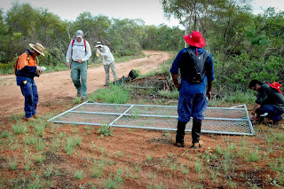
Construction has started on the temporary meteorological tower – Lot 259 James Price Point, Dampier Peninsula.

SMS Redhand received this afternoon 19th November: “Activity on Manari Road. Survey team Walmadan in APT Kimberley Wilderness Adventure Tour bus, truck and loader just south. Concrete pad. tent 4 men. Survey till end of week.”

One of the workers had FUBAR on his shirt which, if you check Wikipedia, is pretty much a good description of the work done on the bush already.
Planning Approval was given at the Shire of Broome Council meeting held on 29th October, for two locations. Option A, the preferred location is where Redhand believes the work is taking place. “This site would require a new track of approximately 3m wide and 100m in length to be established from Manari Road to the tower site. Vegetation would be selectively cleared by ‘scrub roll’ or ‘blade up’ clearing to minimise the extent of clearing of the track. The track in would have a ‘bend’ so the proposed tower could not be viewed directly from Manari Road.”
Well, how ridiculous. That bush has been badly burnt this year and you can see for miles through the burnt undergrowth, which is now after last week’s rain starting to recover with spurts of new green. The Telstra tower at Quondong is just 14m high and is used as a reference point by fishermen, sailors and anyone can see it along the flat part of the country. This meteorological tower is more than twice the height at 30m and only 100m east of Manari Road.
APT Kimberley Wilderness Adventure Tours on its website “Travel the Kimberley with the experts at APT Kimberley Wilderness Adventures, and enjoy all the remote and remarkable places.” Is their bus just a good disguise? The website goes on to say “....The APT Conservation and Charitable Fund was established in 2003 by Geoff McGeary and his wife, Anne, thereby continuing the company's dedication to conservation and responsible tourism. The APT Group has continually focused on achieving best practice in economic, social and environmental responsibility. In conducting its operations, the company strives to minimise its impact on the environment, spread benefits throughout the local economies in Australia and internationally, as well as directly promote and support community well being.” Is this sort of land clearing responsible tourism?

Redhand will be seeking answers to these questions.
When was Heritage Clearance given for this work?
When was the Planning Approval from the Shire of Broome issued?
Is this Option A for the location of the Meteorological tower?
Does the approval include accommodation/dongas and other infrastructure?

And while we’re on the subject of towers how is it that in the same Council meeting a 14m whale watching tower at the Two Moons Whale and Marine Research base (Goonjarr Gooyool Aboriginal Community), also on the Dampier Peninsula was deferred for consultation with tourism peak bodies, adjacent communities and other relevant stakeholders? This temporary meteorological tower of 30m had ‘nil’ consultation. Now that’s inconsistent.

Standing up for the planet Hands off country

Friday, November 13, 2009

What really is the point of the Inquiry

The fire on Seadrill's West Atlas mobile offshore drilling unit and PTTEPA's Montara wellhead platform in the Timor Sea was extinguished on 3 November 2009, following several attempts by Seadrill's West Triton mobile drilling unit to intercept and kill a leaking well.

Seadrill is now working to assess and establish the damage to the West Atlas. Visual inspection confirms that the rig's steel cantilever structure, which is extended over the Montara well-head platform, has been buckled and deformed by the fire.

The next step would be to send a specialist team onboard the West Atlas to establish whether it is safe for additional personnel to board in order to continue well capping operations and to do a full assessment of the structural damage to the West Atlas.

Preliminary indications, based only on the visual inspection of the damage, indicate that it could take a number of months to remove the West Atlas rig from the vicinity of the Montara wellhead platform.

The West Triton currently remains on location, approximately two kilometres from the West Atlas, as it is still required by PTTEPA to monitor and complete well plugging operations.
More more images of the 250 million dollar scrap heap
http://www.news.com.au/gallery/0,23607,5062379-5013959,00.html

Minister Ferguson said, "The Montara Commission of Inquiry is established under amendments to the Offshore Petroleum and Greenhouse Gas Storage Act 2006 I introduced, and which received the support of all parties in the Parliament, in September.”

This Inquiry possesses the powers and authority of a Royal Commission. It will have power to summon witnesses, take evidence on oath and require individuals and corporations to give the Commission documents relevant to its terms of reference. The Inquiry will also receive public submissions. The Commissioner will determine further details of how the Inquiry will be conducted.

Consistent with the proven approach taken by the Australian Transport Safety Bureau the Commission of Inquiry will receive evidence on a “no blame basis”. Independent of the Commission of Inquiry, the relevant regulatory processes will determine whether any non-compliance with the law has occurred and whether any measures to seek penalties and other sanctions should be pursued.

In accordance with the Terms of Reference, Mr Borthwick will investigate and report on:

· The likely cause(s) of the incident;

· The adequacy and effectiveness of the regulatory regime, including approved safety, environment and resource management arrangements;

· The performance of relevant persons in carrying out their obligations under the regulatory regime;

· The adequacy of response requirements and the actual response to the incident;

· The environmental impacts as a result of the incident, including reviewing environmental monitoring plans; and

· The offshore petroleum industry’s response to the incident and the provision and accessibility of information concerning the incident to stakeholders and the Australian community.

Mr Borthwick, the Commissioner will present his report to me before the end of April 2010.

Concurrent with the Commission of Inquiry, the following investigations and reviews are being progressed by the Australian Government:

· NOPSA is investigating all aspects of the incident concerning occupational health and safety;

· The Northern Territory Department of Regional Development, Primary Industry, Fisheries and Resources is investigating all aspects of compliance with the regulatory regime applied under the Offshore Petroleum and Greenhouse Gas Storage Act 2006;

· The Department of Environment, Water, Heritage and the Arts is undertaking an audit of compliance with the conditions of Environment Protection and Biodiversity Conservation Act 1999 approval relating to the drilling and other activities on the Montara wellhead platform; and

· Under the National Plan to Combat Pollution of the Sea by Oil and other Noxious and Hazardous Substances, the Australian Maritime Safety Authority will undertake a separate review into the effectiveness of the response to the incident.

The NATPLAN Review will be chaired by Mr Jim Starkey, an independent consultant with significant executive experience in the petroleum industry, the Australian Public Service and as a former chairman of the National Plan Management Committee responsible for oversight of Australia's oil spill preparedness and response capabilities.

The review team will involve the Australian Maritime Safety Authority, relevant Commonwealth departments, the Western Australian Government and the Australian Marine Oil Spill Centre. Public submissions will be called for and considered.

Redhand believes the terms of Reference should investigate that when oil was spewing into the ocean and effects where being made to stop the flow how was it possible that PTTEP also had time to take over control of five new exploration licences and several oilfields in Australian waters.

Despite growing concerns about the impact of the twelve week oil leak, the $11 million purchase of new oil assets was supported by Federal Resources Minister Martin Ferguson and Australia's Foreign Investment Review Board.

Purchased from fellow oil exploration company OMV, the licences gives PTTEP control of an extra 1480 square kilometres of Australian waters near the burnt out shell of the Montara rig, about 650 kilometres west of Darwin.

The government rejected an amendment from Greens Senator Rachel Siewert to enshrine broad terms of reference for future investigations of this type. She was concerned the probe might only look into the technical and regulatory issues and not review the clean-up operations or the environmental impacts of the spill. The minister says he had already been considering extensive powers for the inquiry in light of a report on the explosion last year at the gas plant on Varanus Island, about 100 kilometres off the coast from the Pilbara town of Karratha.

Thai rig operators PTTEP are said to be paying the Commonwealth for the costs of monitoring the spill. Industry estimates put the final cost of the spill as high as $100 million but the environmental cost, which cannot be expressed solely in dollars and cents, is immense. This is exactly the sort of nightmare scenario state and federal governments must have dreaded as they increase the pace of resource extraction in an attempt to prop up a fragile economy. With Australian manufacturing moving offshore or simply closing their doors and other sectors of the economy slowing in the wake of the global financial crisis, governments are banking on income from big resource customers like India and China.

Environmental concerns over the proposed Gargon gas project off WA’s northwest coast were dismissed by the federal government in August. The scheme incorporates a gas plant on Barrow Island, which lies in the heart of an area dubbed “Australia’s Galapagos”. Part of the “sell” for the project was the introduction of pioneering and unproven carbon dioxide burying technique. Critics claim the unstable sea floor will cause the greenhouse gas to escape and threaten wildlife.

Thursday, November 5, 2009

The fire is out but the scaring is worst


The company responsible for an oil well that spewed its contents into the Timor Sea for more than two months says it knows what caused the environmental disaster.

But PTTEP Australasia chief financial officer Jose Martins has refused to reveal what the reasons for the Montara oil well spill and West Atlas rig fire are.

The well began spilling oil on August 21, while the fire broke out on the rig on Sunday. The clean-up effort was hampered by the time it took to get a second rig in place to drill a relief well, while it also took several attempts to finally stop the leak yesterday.

"Yes we do (know the causes), there's a range of causes but we're not going to go into it," Mr Martins told ABC Radio.

"There's going to be a proper legal process that would be undertaken to find out what caused the leak.

He also revealed he expected an insurance claim to recover costs of the incident to be "much higher" than the $170 million it had cost the company so far, to take into account costs of the rig fire.

The clean-up has cost the company about $5 million so far, but this could also rise, Mr Martins said.

PTTEP would not request any federal government help.

The clean-up was expected to take another two months, but it could take up to seven years to work through the environmental effects of the disaster, Mr Martins said.

PTTEP was prepared to be paying for the incident for several years.

Engineers would attempt to plug the well soon, and when that happened a relief well drilled to plug the leak could then be abandoned.

Despite the effects of the incident, Mr Martins refused to apologise.

The company was "confident" it was not to blame.

"The accident shouldn't have happened in the first place," Mr Martins said.

"We regret what's happened and I think the rest will have to come out in the inquiry.

Sunday, November 1, 2009

West Atlas is Burning


A fire has broken out at an oil well that has been leaking in the Timor Sea for 10 weeks.

PTTEP Australasia says the West Atlas rig and Montara well head platform are on fire. All personnel on the nearby West Triton rig and on work vessels in the area are reported to be safe. Oil has been spilling into the Timor Sea at an estimated rate of 2000 - 6000 barrels a day since August 21.

The Australian Maritime Safety Authority has 300 people working on the clean-up. Redhand would like to know where are the 300 hundred people who were apparently cleaning up this spill? Where were they when the rig caught fire? Where have these 300 hundred people come from? Have they been flown in from Darwin or Broome? Are they being accommodated in Darwin or Broome?

How was this fire stated? How do they intend to deal with this massive disaster now?

Now that this rig is on fire, Redhand believes that it is about time that both the Pearling Industry, Local fishing Industry, the Kimberley Tourism Industry, the Broome Chamber of Commerce, the local Shires and regional peak bodies start to take a serious look at this global disaster. They must at least, begin to come to terms with the facts that this spill and the subsequent fire is going to have ominous and dire consequential ramifications for all these Industries and local and regional governance. The oil will eventually run the entire Dampier coastal foreshore and will make its way to Cable Beach.

In the light of this global significant disaster, that can be viewed from space, what Risk Management Strategies does the Shire of both Broome and Derby and the state government have in place to deal with this particular oil spill or any other major industrial or tanker accidents that could take place anywhere along the western Australian coastline?